
地理院地図をフォークしたもの
2015年01月26日
地理院地図のソース をフォークしたもの。
地理院地図をフォークしたもの
に、独自の改良を加えてみる。
地理院地図をフォークしたもの
に、独自の改良を加えてみる。
History
- ■2015-01-26
- タイルのY軸が反転したものに対応
layer.txtに"tms": trueを追加する。
例
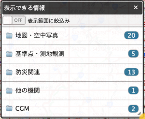
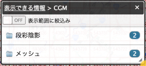
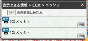
{ "type": "Layer", "id": "mesh1", "title": "1次メッシュ", "iconUrl": "http://cyberjapandata.gsi.go.jp/portal/site/mapuse4/js/skin/photo.png", "url": "http://www2.chuogeomatics.jp/drmmap/tms/1.0.0/mesh1@g20/{z}/{x}/{y}.png", "tms": true, "subdomains": "", "attribution": "", "cocotile": true, "minZoom": 1, "legendUrl": "", "html": "" } - ■2015-01-26
- レイヤーを追加